Start your day with intelligence. Get The OODA Daily Pulse.
Start your day with intelligence. Get The OODA Daily Pulse.

Source: Russia-Ukraine Monitor Map
Bellingcat (an innovative open-source investigative journalism network and business model) has been in our research arsenal for a while – ripe for a post to introduce our readers to their tools, investigations, and innovative approach to networked journalism. The war in Europe has now put Bellingcat in the spotlight, based on the growing popularity of their crowdsourced mapping and monitoring efforts.
Bellingcat is an independent international collective of researchers, investigators, and citizen journalists using open source and social media investigation to probe a variety of subjects – from Mexican drug lords and crimes against humanity to tracking the use of chemical weapons and conflicts worldwide. With staff and contributors in more than 20 countries around the world, Bellingcat operates in a unique field where advanced technology, forensic research, journalism, investigations, transparency, and accountability come together. (1)
Bellingcat’s innovative approaches to using publicly available data and citizen journalist analysis have been particularly significant for advancing narratives of conflict, crime, and human rights abuses. They have produced investigations on these issues in coordination with partners and allies and expanded their training so that a growing corps of citizen journalists is poised to pursue these stories alongside them.
Bellingcat’s most popular posts of the last year included analysis of the April 7, 2018, chemical attack in Douma, Syria; exposure of a fake persona who had been widely cited in Ukrainian and anti-Putin Russian media as a Pentagon official; the illegal shipping of precursors of the nerve agent Sarin to Syria by Belgian companies; the Syrian Arab Army’s armored vehicle losses; and the use of drones by non-state actors in Syria and Iraq. Their most significant publications have included identifying a key suspect in the Malaysian Airlines Flight 17 investigation as a high-ranking Russian intelligence officer and identifying suspects in the Skripals poisoning as Russian intelligence officers as well. Their reporting has also been covered extensively by a range of international news media.
The Russia-Ukraine Monitor Map is a crowdsourced effort by the Centre for Information Resilience (CIR) and the wider open source community to map, document, and verify significant incidents during the conflict in Ukraine. Its aim is to provide reliable information for policymakers, journalists as well as justice and accountability bodies about the evolving situations both on-the-ground and online. Bellingcat, Mnemonic, and the Conflict Intelligence Team have also begun to contribute to the map. (2)
Benjamin Strick is a digital investigator with a background in law, military, and technology and is the Director of Investigations for the Centre for Information Resilience (CIR). He specialises in open source intelligence (OSINT), satellite imagery, influence, data, and maps. Below, Ben gives an overview of the map and how it can be utilized:
At CIR we began mapping out verified incidents surrounding the build-up of Russian troops, and later the beginning of the conflict in Ukraine, so that as many people as possible could have access to reliable, accurate information about what is going on and to boost the integrity of the information environment.
The map is publicly viewable on both desktop and mobile and, as of 24 February, has had almost 500,000 views. It had also logged more than 570 items to give an up-to-date, detailed view of what is happening in Ukraine.
You can also view the map here.
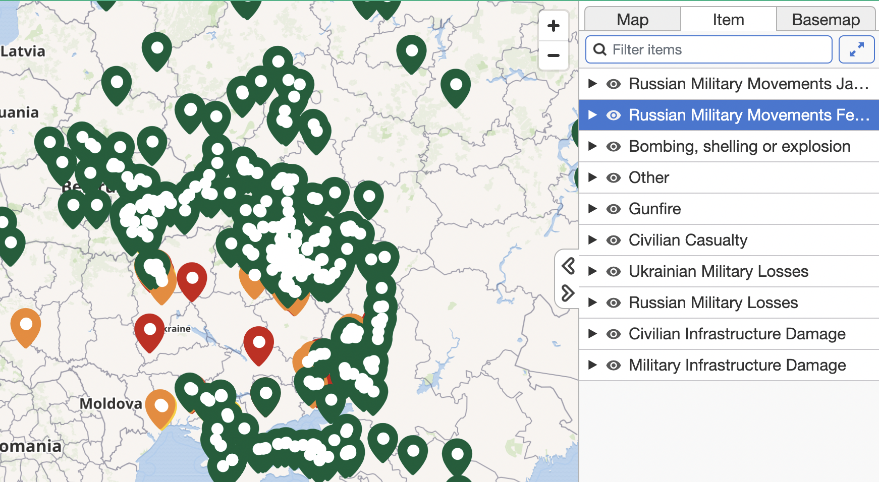
A first look at the map shows that there are a lot of pins. Each one represents an incident or event depicted through video, photo, or commercial satellite imagery and has undergone a rigorous verification process to identify where and when it was taken.
The verification work is carried out by open source investigators as well as the wider community through the processes of geolocation and chronolocation. Once collected from social media, the content is logged in a central database where the material is archived for future use by researchers, reporters as well as justice and accountability bodies.
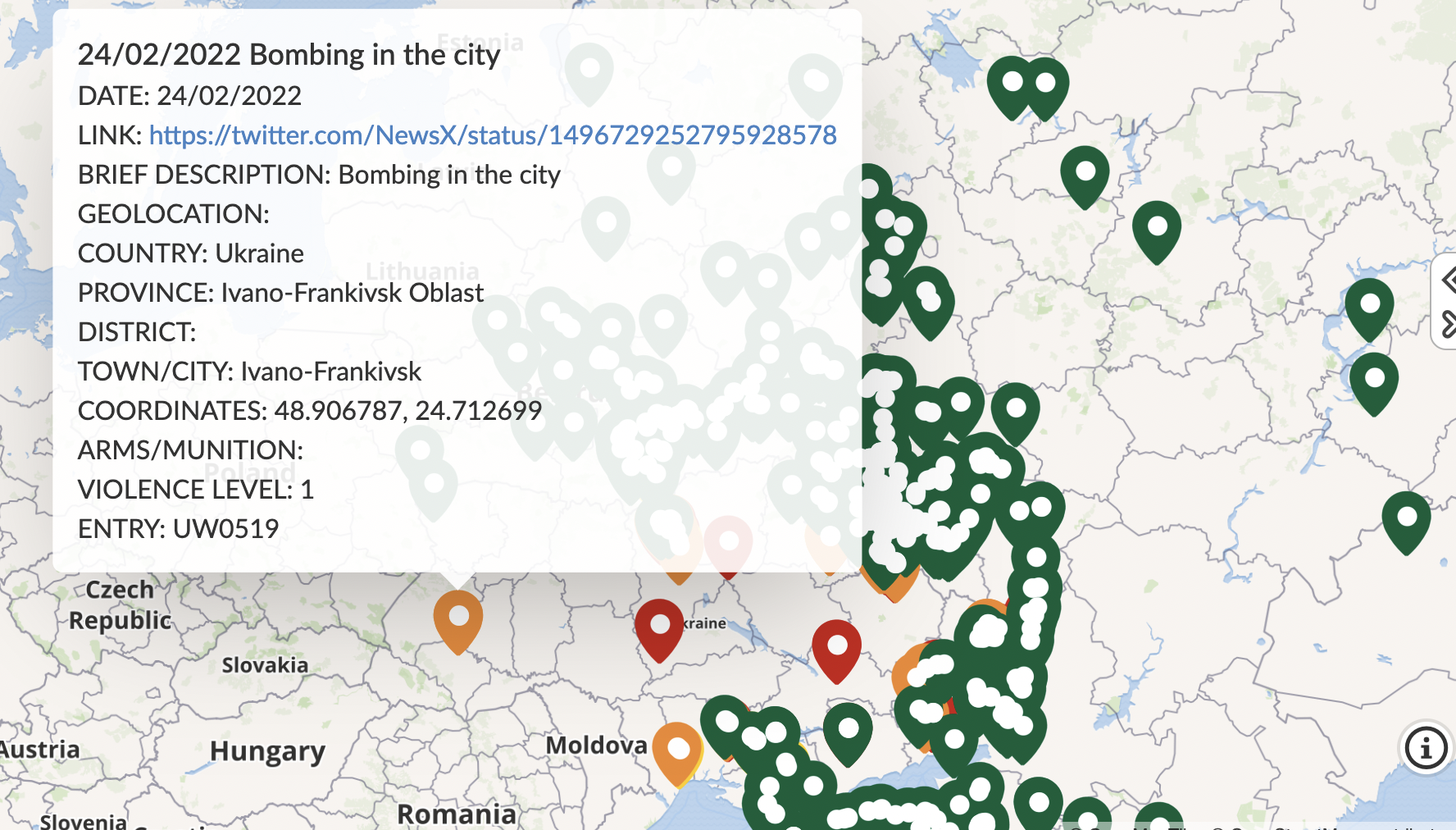
Each piece of information that you see on the map is checked for its content and given a brief description so that keywords can be searched to look for specific trends, patterns or to dive into the verified data.

A screen grab of the Russia-Ukraine Monitoring Map detailing a bombing in Ivano-Frankivsk.
We also take mental health and the sharing of graphic material seriously and part of our core process involves our investigation teams rating content on the map with a violence scale from one to five. One represents minimal or no violence, while five details that footage is of a severely graphic nature. This is to serve as both a warning for future researchers of the nature of the posts when being reviewed, as well as for the wider public when dealing with such resources
Before any content makes its way onto the map, it is further reviewed by senior investigators at the CIR to ensure the information is accurate and safe.
There are different coloured pins on the map. This is to isolate specific categories of footage. On the right of the map, this list of categories can be found. Each of these is assigned a colour class. It must be noted that the categories may change as the conflict in Ukraine develops. At time of writing, the pins on the map are allocated to categories such as Russian military Movements, bombings, civilian casualties, military losses, infrastructure damage and gunfire.

A screen grab of the Russia-Ukraine Monitoring Map detailing a list of categories (right) that can be searched.
The pins are sorted by date of publication of footage or chronolocation. In some instances, footage may be published days after the actual incident. This is due to our investigations taking the time to be as accurate as possible.
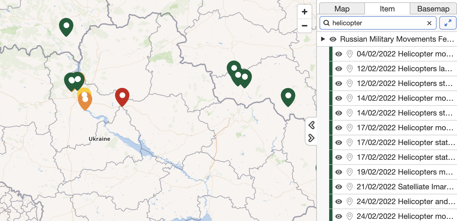
The map is also searchable using the ‘filter items’ box above the categories.
This allows for searches of dates, specific weapon systems, if there are vehicles with descriptors such as the letter ‘Z’ (as has been detailed in numerous media reports) or in specific areas.

A search for the term “helicopter” using the filter box of the Russia-Ukraine Conflict Map brings back results.
A more refined view can also be made by clicking on the visibility icon of the categories to isolate pins and show only pins from one category.
There is already a significant amount of information on the map for viewers to explore and it will continue to be updated in the days and weeks ahead.
A Link to the Monitor Map: Russia-Ukraine Monitor Map by Cen4infoRes · MapHub
https://oodaloop.com/archive/2022/03/04/the-russian-invasion-of-ukraine-perspectives-for-the-c-suite-decision-maker/
Now more than ever, organizations need to apply rigorous thought to business risks and opportunities. In doing so it is useful to understand the concepts embodied in the terms Black Swan and Gray Rhino. See: Potential Future Opportunities, Risks and Mitigation Strategies in the Age of Continuous Crisis
Use OODA Loop to improve your decision-making in any competitive endeavor. Explore OODA Loop
The greatest determinant of your success will be the quality of your decisions. We examine frameworks for understanding and reducing risk while enabling opportunities. Topics include Black Swans, Gray Rhinos, Foresight, Strategy, Stratigames, Business Intelligence, and Intelligent Enterprises. Leadership in the modern age is also a key topic in this domain. Explore Decision Intelligence
We track the rapidly changing world of technology with a focus on what leaders need to know to improve decision-making. The future of tech is being created now and we provide insights that enable optimized action based on the future of tech. We provide deep insights into Artificial Intelligence, Machine Learning, Cloud Computing, Quantum Computing, Security Technology, Space Technology. Explore Disruptive/Exponential Tech
Security and resiliency topics include geopolitical and cyber risk, cyber conflict, cyber diplomacy, cybersecurity, nation-state conflict, non-nation state conflict, global health, international crime, supply chain, and terrorism. Explore Security and Resiliency
The OODA community includes a broad group of decision-makers, analysts, entrepreneurs, government leaders and tech creators. Interact with and learn from your peers via online monthly meetings, OODA Salons, the OODAcast, in-person conferences, and an online forum. For the most sensitive discussions interact with executive leaders via a closed Wickr channel. The community also has access to a member-only video library. Explore The OODA Community